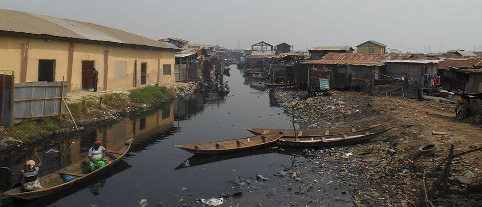
Most Lagos flooding that residents experience day-to-day is pluvial: intense rainfall overwhelms drainage, water ponds in low spots, and streets become rivers. Lagos’ adaptation framing notes flat terrain, poorly drained soils, and that an additional share of land is subject to seasonal flooding. Arup’s Lagos water resilience report also highlights flooding as a key recurring challenge, driven by factors including insufficient drainage and loss of blue/green infrastructure.
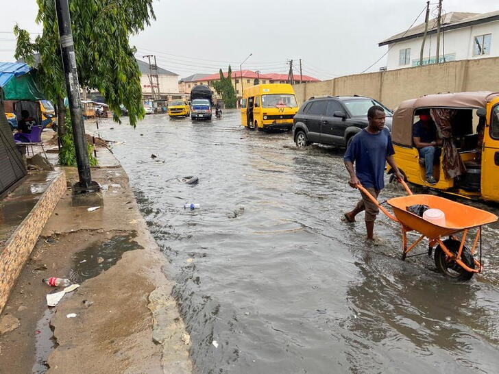
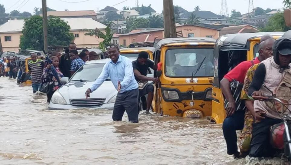
Flood leaves residents stranded in Lagos communities_Source: reuters.com(1) & vanguardngr.com(2)
What this zone is
The inland basins are the mainland interiors—areas that slope gently toward the coast and lagoon. Tund” in the way inland cities imagine; they’re low-relief landscapes where small elevation differences determine whether a neighbourhood drains or pools.
These inland areas are also structured by drainage channels and river basins. Arup’s report references the broader basin context (including the Ogun–Osun system) and notes Lagos’ complex mix of surface and groundwater.
Flood drivers inland
- Short, intense storms that exceed pipe capacity.
- Blocked drains and encroached channels (right-of-way loss).
- Too much hard surface: rooftops and asphalt shed water fast.
- Lack of safe overflow routes: when drains exceed capacity, water has nowhere designed to go.
A very Lagos-specific reality: major drainage channels require constant maintenance and enforcement. Lagos State’s Ministry of Environment and Water Resources has referenced the “System 1” channel, Odo Iya Alaro (Ojota to Lagoon), as part of major drainage maintenance efforts.
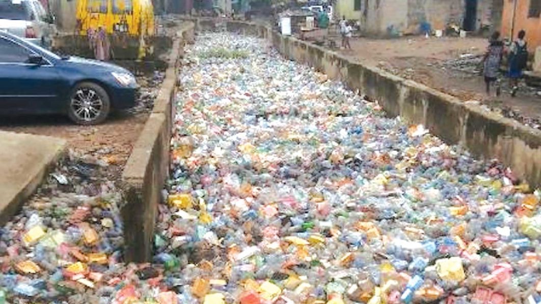
Lagos canal (Source: guardian.ng & newsrounds.econaiplus.com)
Theoretical lens: “design for exceedance” + “sponge city”
Inland resilience isn’t about making drains infinitely big. It’s about:
- Capturing water near where it falls (retain/detain).
- Moving water on the surface safely when systems exceed capacity (exceedance routes).
- Storing water temporarily in public space (squares, parks, schoolyards).
- Infiltrating where soils allow; filtering where they don’t.
This is the core of water-sensitive urban design and “sponge city” thinking.
Best solutions and design principles for inland Lagos
1) Blue Streets + Cloudburst Boulevards
Regrade key corridors so streets become safe channels during extreme rain: sunken lanes, swales, tree trenches, and curb cuts that route water to detention parks.
Global example: Copenhagen’s Cloudburst Management Plan established a citywide approach combining surface blue-green solutions and (where needed) subterranean measures, prioritizing flood hotspots and long-term implementation.
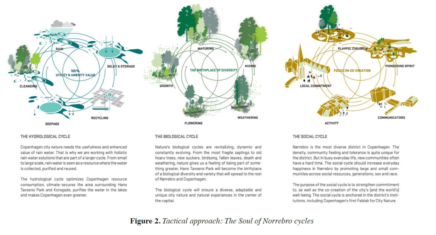
Copenhagen's Cloudburst Management Plan (CMP) is a comprehensive strategy developed to address flooding caused by extreme rainfall events, focusing on sustainable, nature-based solutions. Sourcs: (academiccommons.columbia.edu)
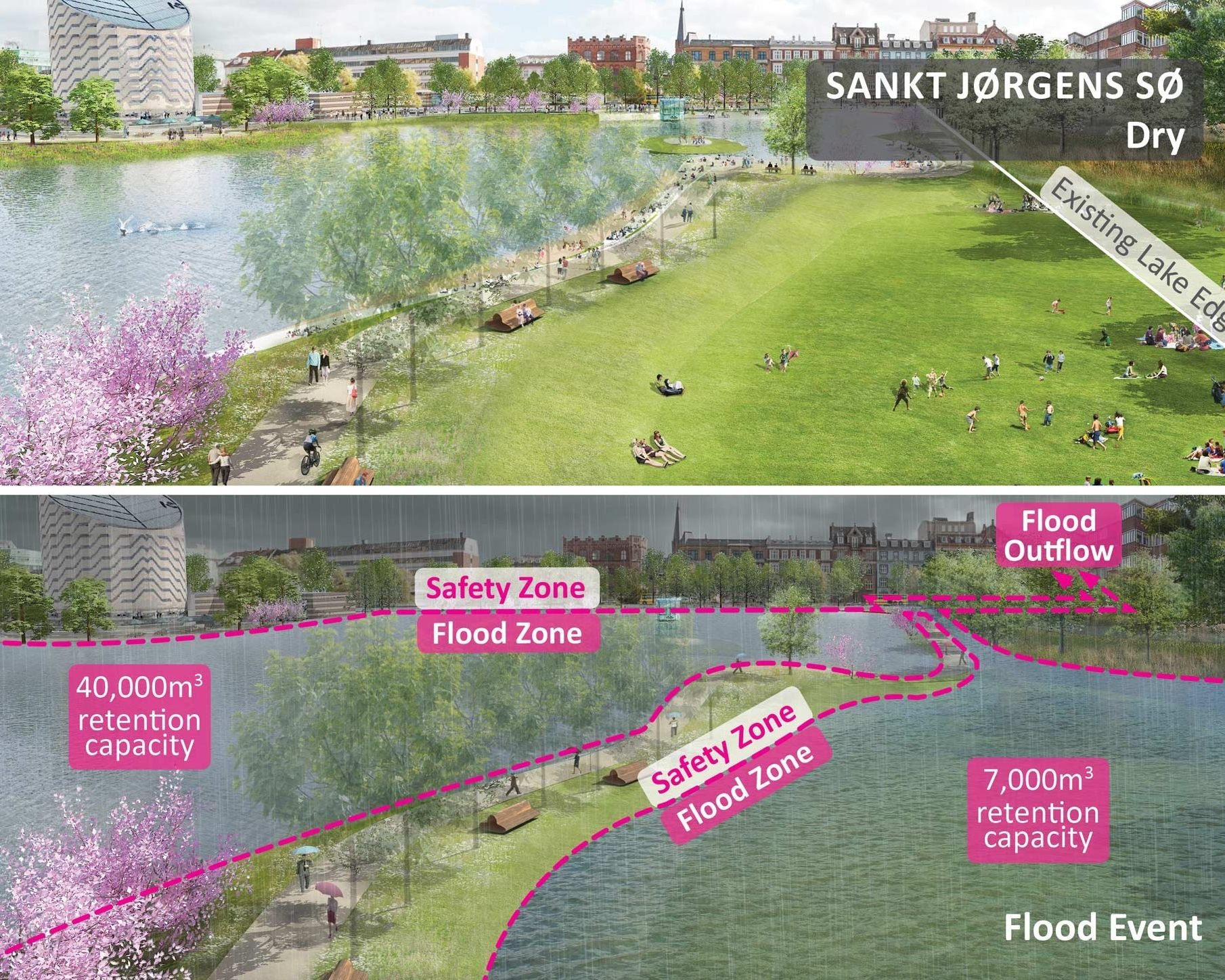
Cloudburst Management Plan - Copenhagen_(Source: interlace-hub.com)
2) Water Squares (public plazas that store stormwater)
Water squares make storage visible: they’re dry most days—sports courts, markets, gathering space—but they become basins during storms.
Global example: Watersquare Benthemplein, Rotterdam (De Urbanisten) combines public space and stormwater storage in one place.
3) “Sponge Parks” and detention landscapes
Neighborhood parks designed with subtle basins, ponds, and wetlands can hold peak runoff and release it slowly.
Global example: Qunli Stormwater Wetland Park, Harbin (Turenscape) is a built wetland park that collects, filters, and stores stormwater as landscape infrastructure.
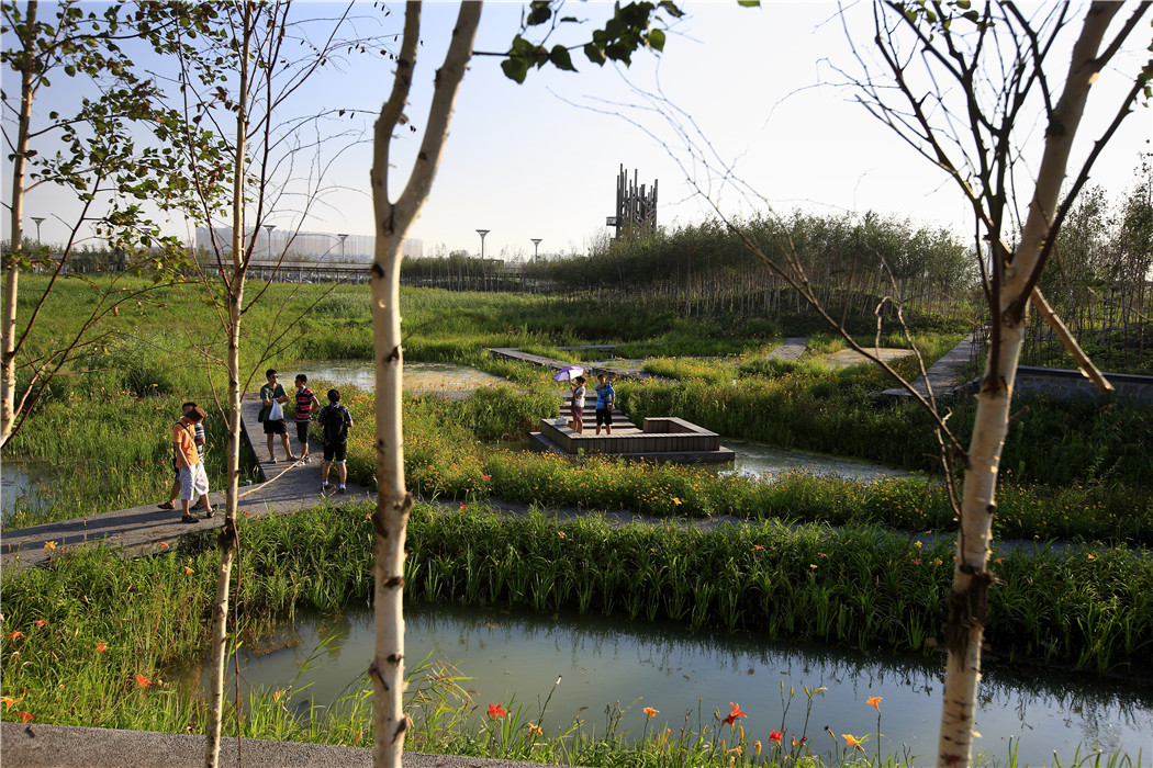
Harbin Qunli Stormwater Park, China. Through the transformation of this dying wetland, storm water that frequently causes flood in the city become a positive environmental amenity for the city. The storm water park now has been listed as a national urban wetland park._(Source: turenscape.com)
4) Daylighting and naturalizing canals
Convert straight, fenced concrete channels into wider, vegetated waterways with flood terraces—more capacity, better ecology, better public space.
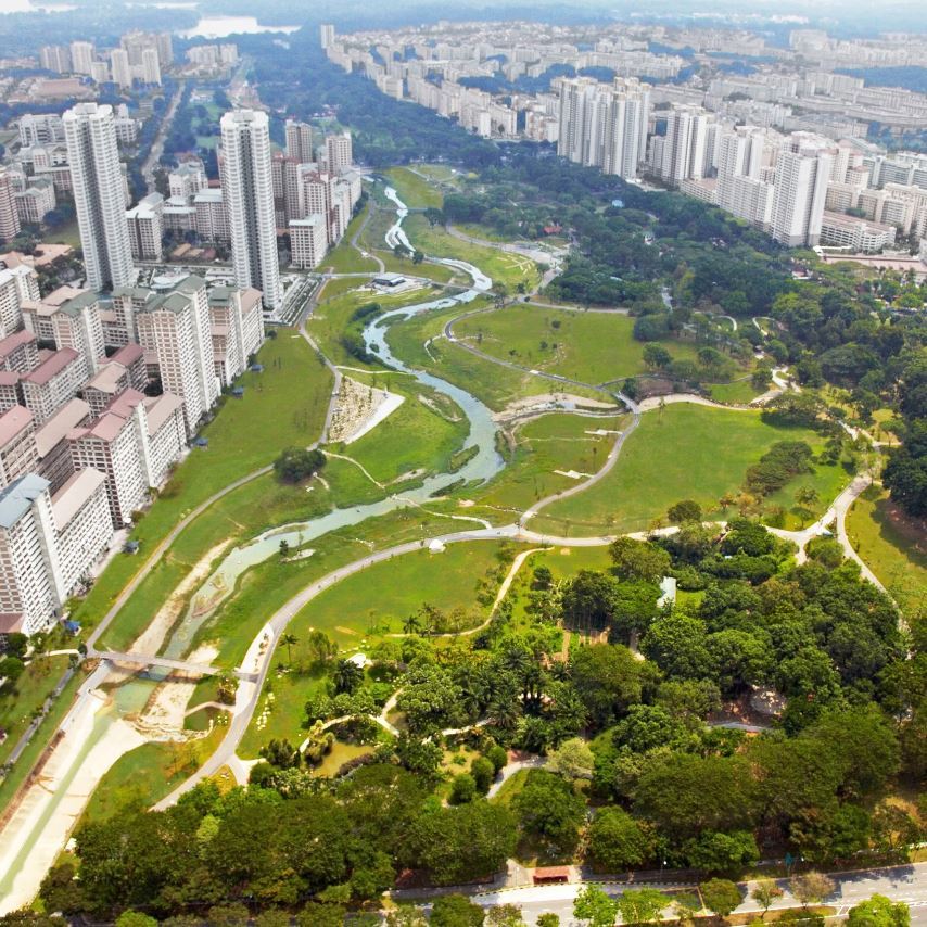
Global example: Bishan–Ang Mo Kio Park, Singapore (Ramboll Studio Dreiseitl) transformed a concrete canal into a naturalized river system, increasing flood capacity while producing a major civic park.
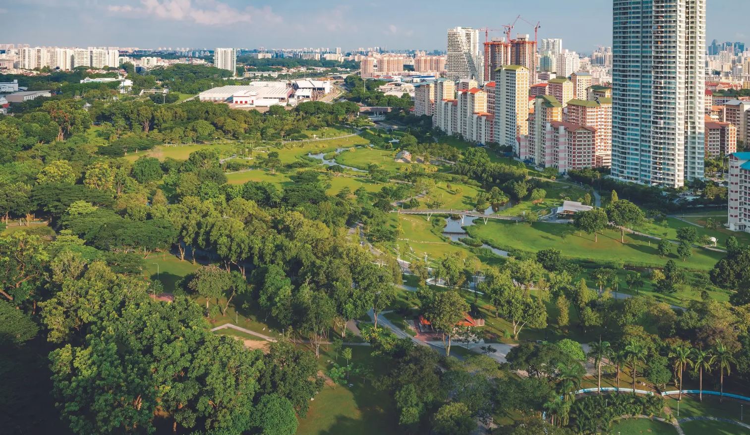
Bishan Park, Singapore: Converting a concrete canal into a river with dynamic nature-oriented spaces for Singapore’s communities. The 62 hectare park is one of the most popular in the city state, redesigned to accommodate the dynamic processes of the river system and provide a lush natural environment for visitors. (Source: ramboll.com)
Bishan Park, Singapore_(Source: dreiseitlconsulting.com)
5) Linear “Sponge” edges along polluted waterways
Where waterways are degraded, build linear rain gardens and wetland edges that intercept runoff, filter pollutants, and create open space.
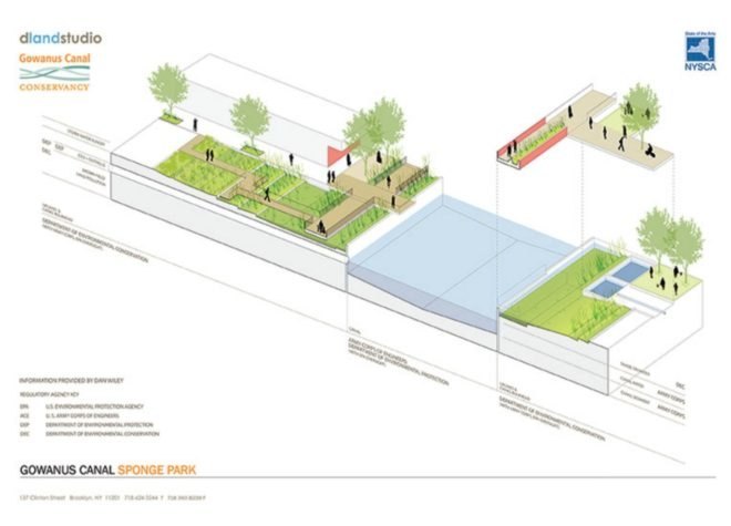
Global example: Sponge Park, Gowanus Canal (DLANDstudio + partners) captures and cleans stormwater runoff at the canal edge while adding public space.
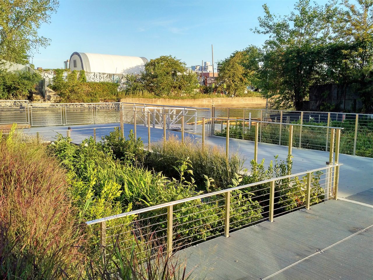
The Gowanus Canal Sponge Park by DLAND Studio Architecture (Source: The Gowanus Canal Sponge Park_DLAND Studio)
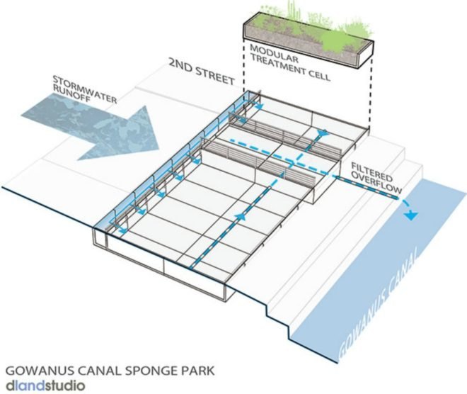
Pic.1: Under the park's greenery lies a strategic system that involves rerouting stormwater from the surface to two channels underneath the walkway. (Source: inhabitat.com)
Pic.2: Various woody plants with phytoremediative qualities were planted to help filter out heavy metals and biologicial toxins from the contaminated water as it passes to the channels. (Source: inhabitat.com)
A Lagos-ready inland playbook (practical, buildable)
- Map the water’s desire lines: where it flows during peak storms (today it’s chaotic; design it to be safe).
- Pick “stormwater districts”: a few inland catchments where you implement the full toolkit—blue streets feeding detention parks feeding major channels.
- Turn schools and markets into water assets: water squares + shade + play + storage.
- Treat big channels as linear parks where possible: access + maintenance + safety + capacity.
- Build maintenance into the design: trash capture, easy-to-clean inlets, visible channels, community stewardship—because a perfect design fails if it clogs.
Inland Lagos doesn’t need to wait for one mega-project. It can become resilient through hundreds of small, connected landscape moves—streets, parks, and public spaces that collectively form a stormwater network.
